

Shortly after the border town “Ipiales” I crossed the border to Ecuador. The border crossing went smoothly and after a few minutes I was now driving in the 11th country of my trip. In the next bigger town “Tulcan” I first organized a new sim card, changed my money and prepared everything for the next days.
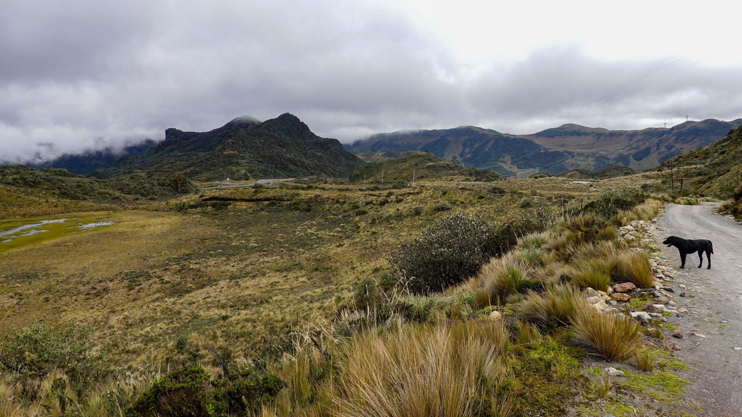
The following morning my route led me to the “Páramo el Angel”, one of the largest nature reserves in the highlands of Ecuador. Páramo means “bad, treeless land” and is a vegetation type of the treeless, alpine highland steppes in the mountains near the equator in Colombia, Ecuador and Peru. These highlands are located above 3500 meters, are characterized by high precipitation and year-round temperatures ranging from about 5°C to -5°C. The nature is rough, inhospitable but absolutely impressive and beautiful. Characteristic are the treeless areas, the low shrubs and especially the crested rosette plant, which grows up to a maximum of 3 meters high.
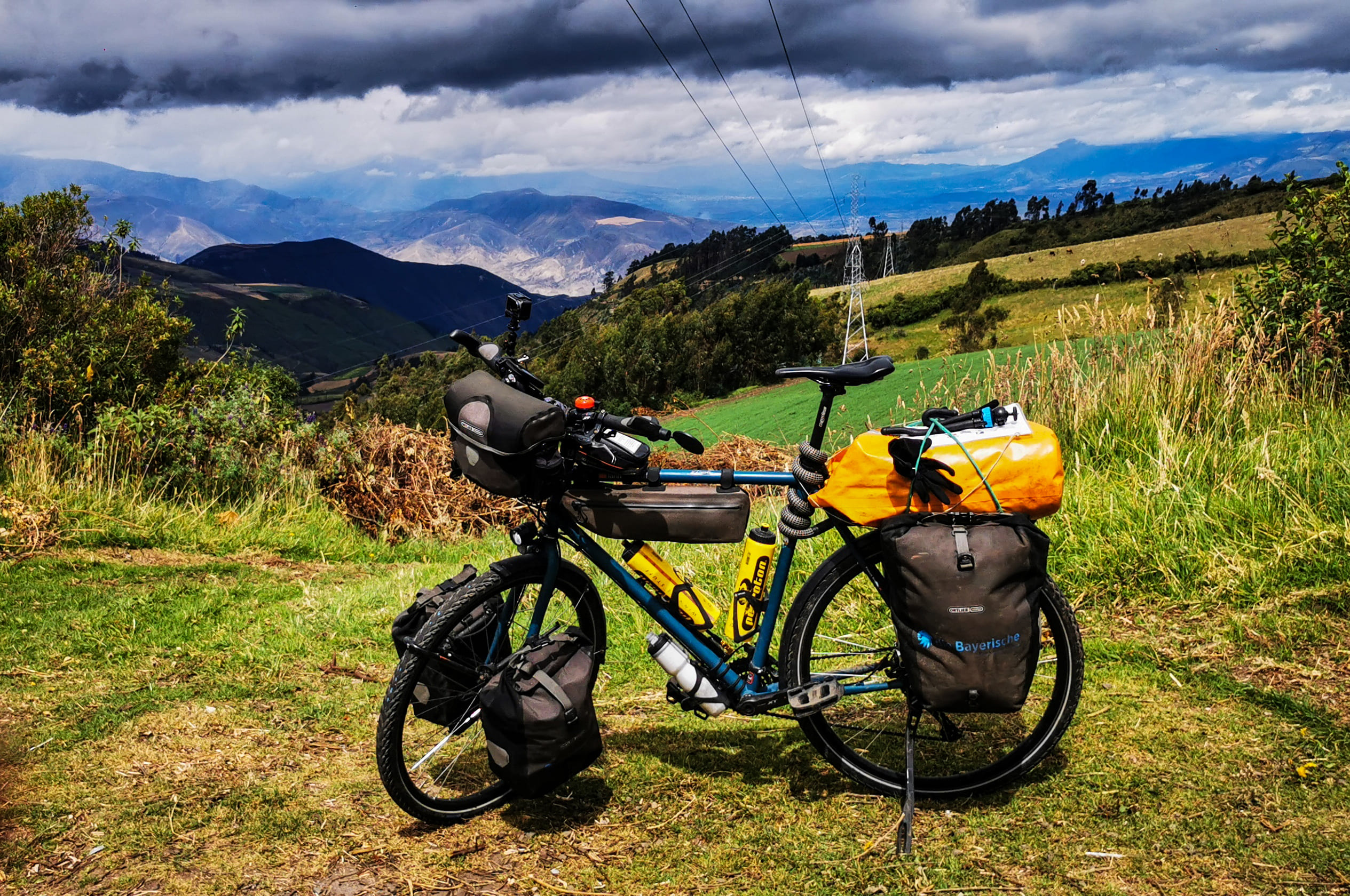
When planning my route, I was shown that the roads would be partially paved or at least well compacted gravel roads. Since I already thought it would be a bit tougher, I planned enough time for the next 50 km, but assumed that I would arrive at the finish point no later than early afternoon, since there were not too many meters of altitude to overcome.


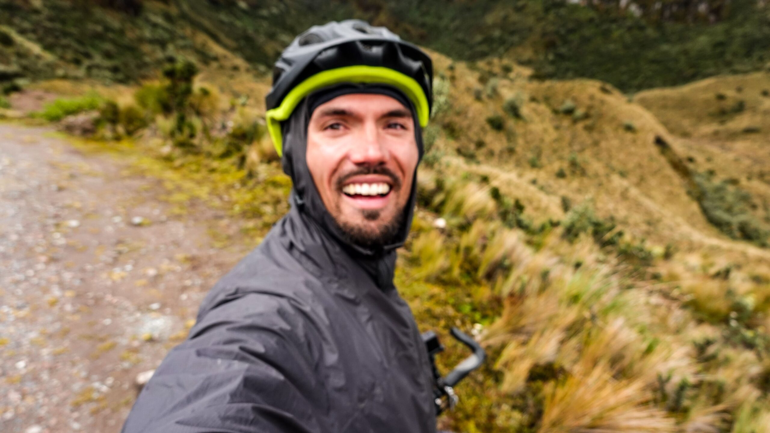
As soon as I drove out of town, the road abruptly changed to a gravel path. It was a far cry from a paved road, but at least it was a properly paved path. The higher I went and after I passed the last homestead, the road became a hiking trail. It was cloudy and fresh the whole time but fortunately it wasn’t raining. Not yet! As soon as I got above 3300 meters, I drove into the fog and it started pouring. By the time I got below that altitude, which didn’t happen until the end of the day, it wouldn’t stop raining either. Thickly wrapped up with all my rain gear, it went higher and higher and got colder and colder.
Due to the extreme humidity, there were constant landslides and for several kilometers the path was partly completely cut off and totally muddy. Through deep puddles and along the steep slopes I had to push my bike for the most part. At times I was stuck deep in the mud and had great difficulty heaving the heavy bike through these places. After several hours away from civilization, my GPS also failed. This had never happened to me before on my whole tour. Due to the fog and all the rain clouds, not only was my visibility severely limited, but also any signal was interrupted. Gradually concerns and doubts crept up in me whether I could create this tour in one day at all. The icy cold and the continuous rain strengthened still the doubts. I calmed myself with the thought that I had a good tent and a very good sleeping bag. I also had something to eat with me, so I could have cooked a warm soup. There was plenty of water. I told myself not to worry, because I would arrive in the next village the next day at the latest.
Two hours later, the GPS device turned on again and gave signs of life. In this time I had advanced just 5 km. Much too slow to arrive before nightfall in the next village. I still had to go about 10 km further uphill to 3700 meters and then it was supposed to be all downhill. It became colder and colder and also the rain did not let up. At least the road was no longer interrupted by landslides and I was able to make a little faster progress. Arrived at the highest point was a Refugio, an excursion hut, in which could also be camped. Unfortunately, no one was there that day and everything was deserted. On days with nice weather, this is certainly a great place for a hike in the “Páramo”, but soaking wet and frozen through I just wanted to get into a warm and dry shelter. So I had to move on.


The descent was quite slow due to the many large stones. Hindered by my somewhat limited sense of balance, I frequently had to dismount and interrupt the ride. As if that wasn’t slow enough, I was also besieged by dogs a few times. I was already often reported that in Ecuador many dogs live on the street but so extreme I had not imagined. As soon as I drove off after a few kilometers by the first farms there were in droves dogs which pursued me and defended extremely aggressively barking their district. Once there were at least 10 dogs that surrounded me. In this situation it is important to get off the bike immediately, because the dogs then keep a certain distance. Often they bare their teeth and bark like crazy but do not attack you. Quite tense and in attack mode, I collected several stones and threw them at them. Fortunately, they fearfully retreated and I could continue. Finally, when I was at the end of my strength, the barking dogs annoyed me so much that I was probably already more aggressive than they were.
Exactly at nightfall I reached the village “El Angel” very relieved and took a hotel with a warm shower to recover.

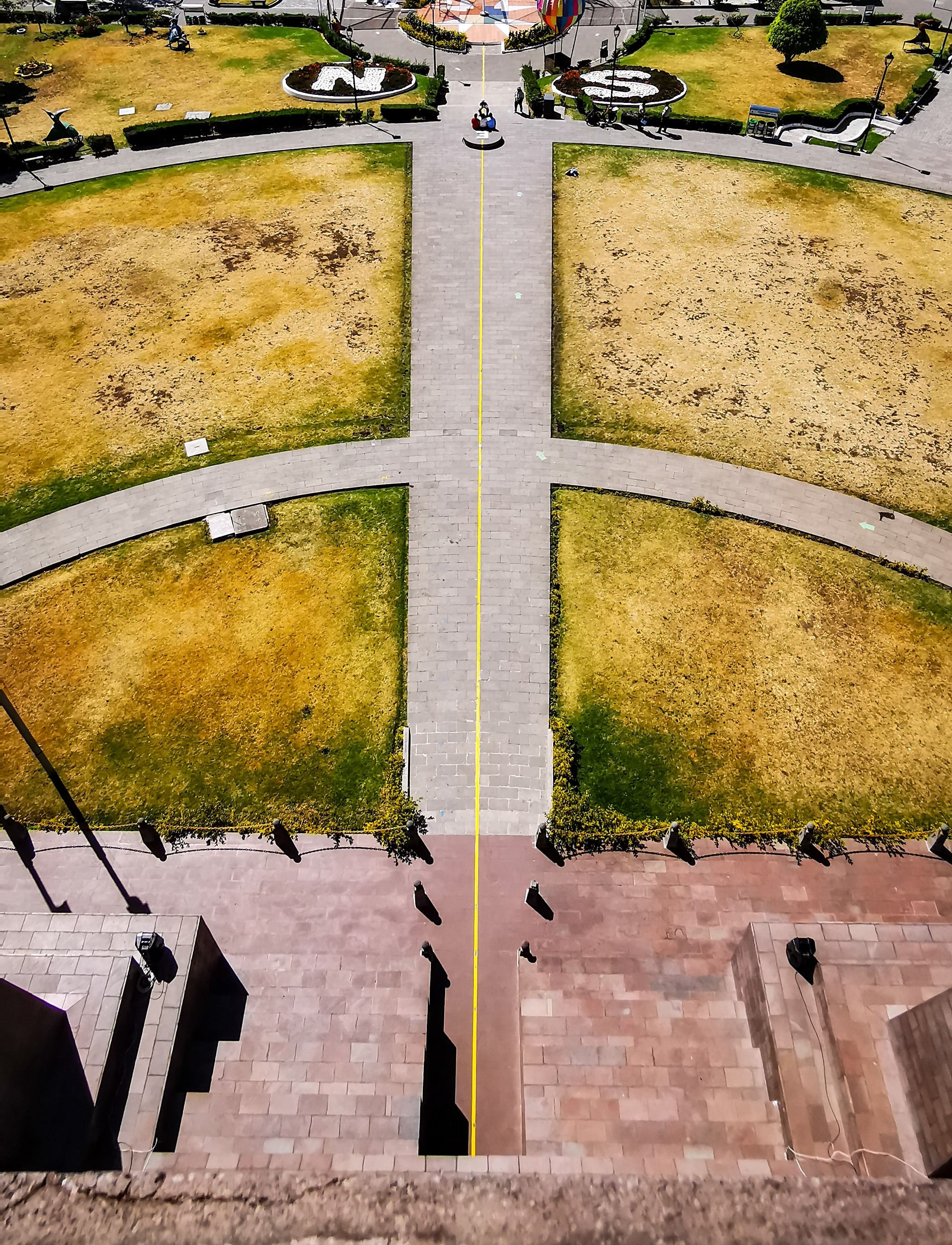
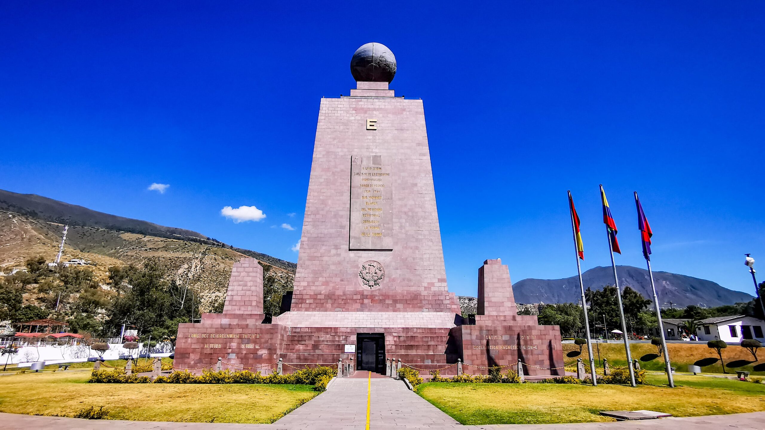
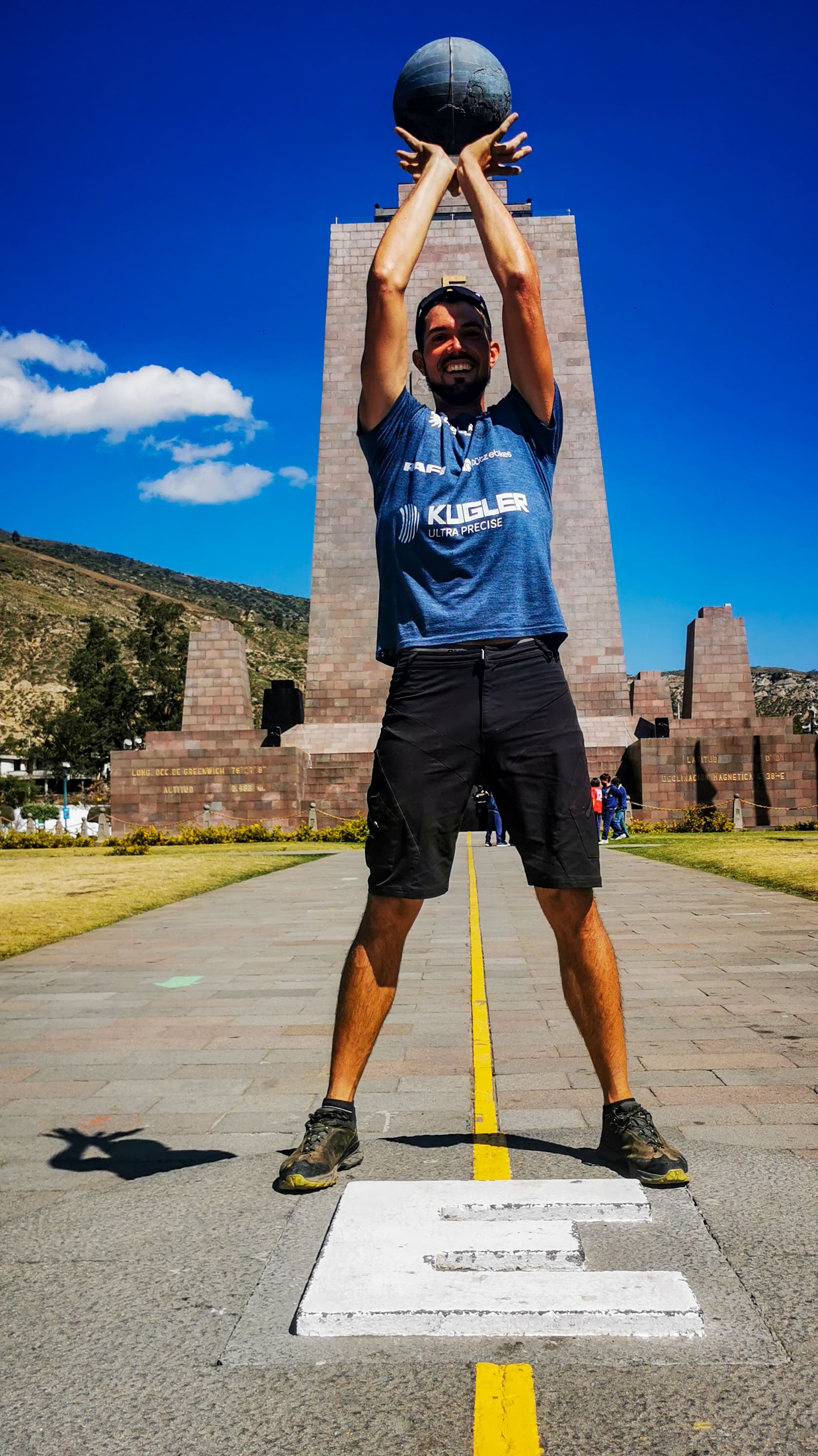
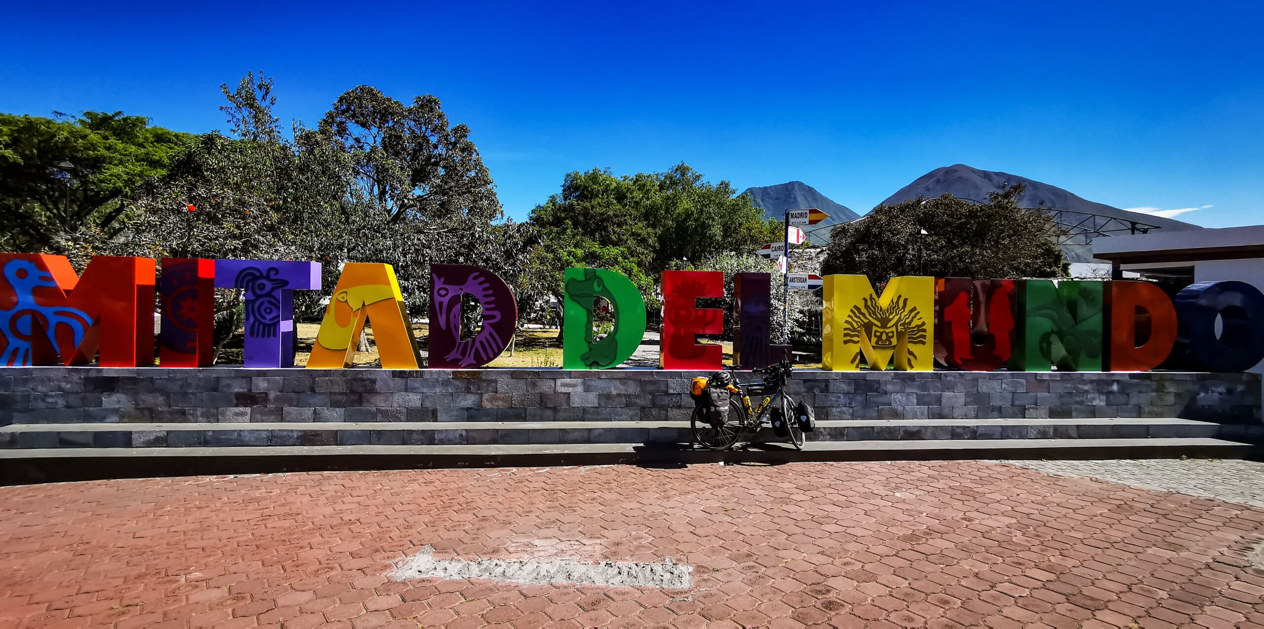
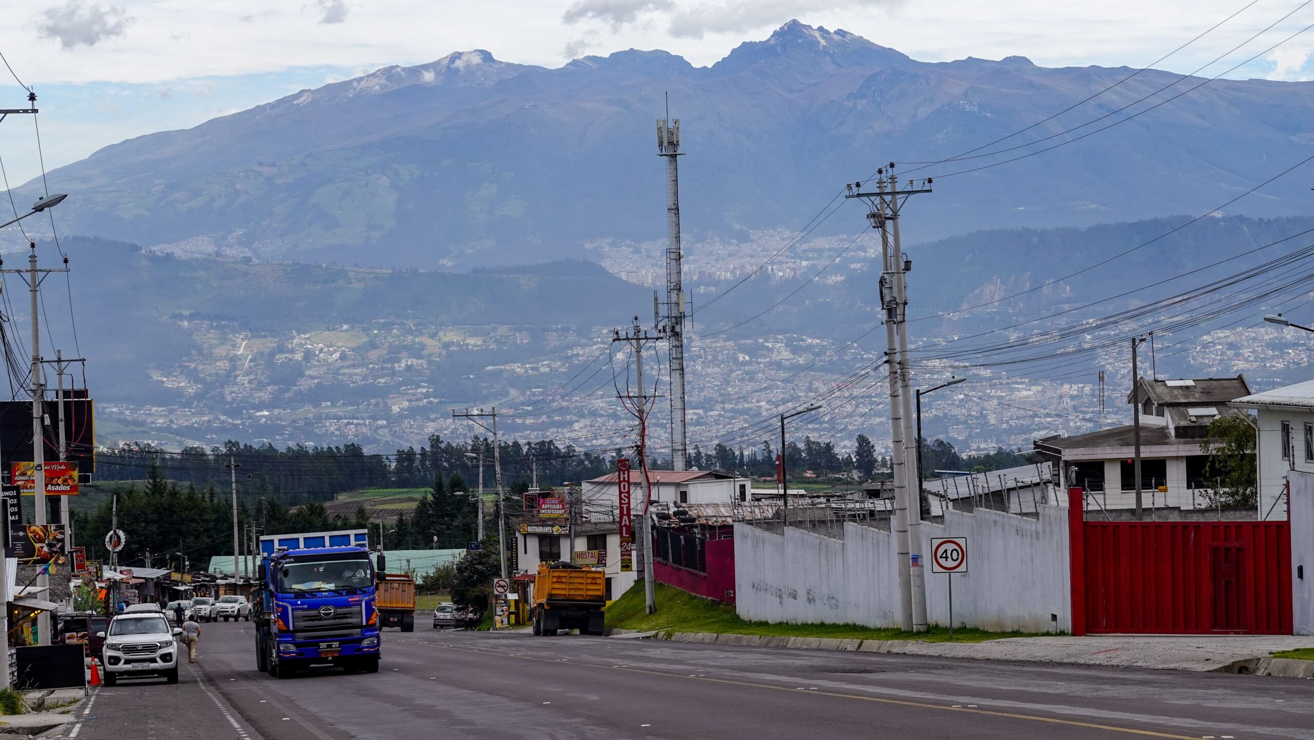
The following day we went far downhill again into an almost desert-like valley and then, how could it be otherwise, steeply uphill again to the beautiful historic small town of “Otovalo”. From here it was only 95 km to “Quito” and the equator. The next morning it went first again 1000 meters uphill. On my way a car passed me honking wildly and stopped shortly before me. Confused what that was supposed to do I stopped and a man came running towards me beaming with joy. It was Luis, whom I had met a few days earlier on the way to “Pasto”. He was on his way to “Quito” with friends for a weekend trip and recognized me as I drove by. Luis told me that they wanted to visit the park at the equator line the next day. As luck would have it, we met there a third time. The equator line runs in the northern part of “Quito” in the “Park Mitad del Mundo”, the center of the world. In the center there is a tower that stands directly on the equatorial line. What a special firing feeling. I started from Canada and 13,000 km and 11 months later I cross the equator.

In “Quito” I spent two days with the “Wamshowers” host Joanne, an Englishwoman who lived in Germany near my home for some years and has been working in Ecuador as an English teacher for several years. Although not an active cyclist, she is keen to help others and warmly welcomed me into her home. Together with her daughter and her partner we spent a nice evening.

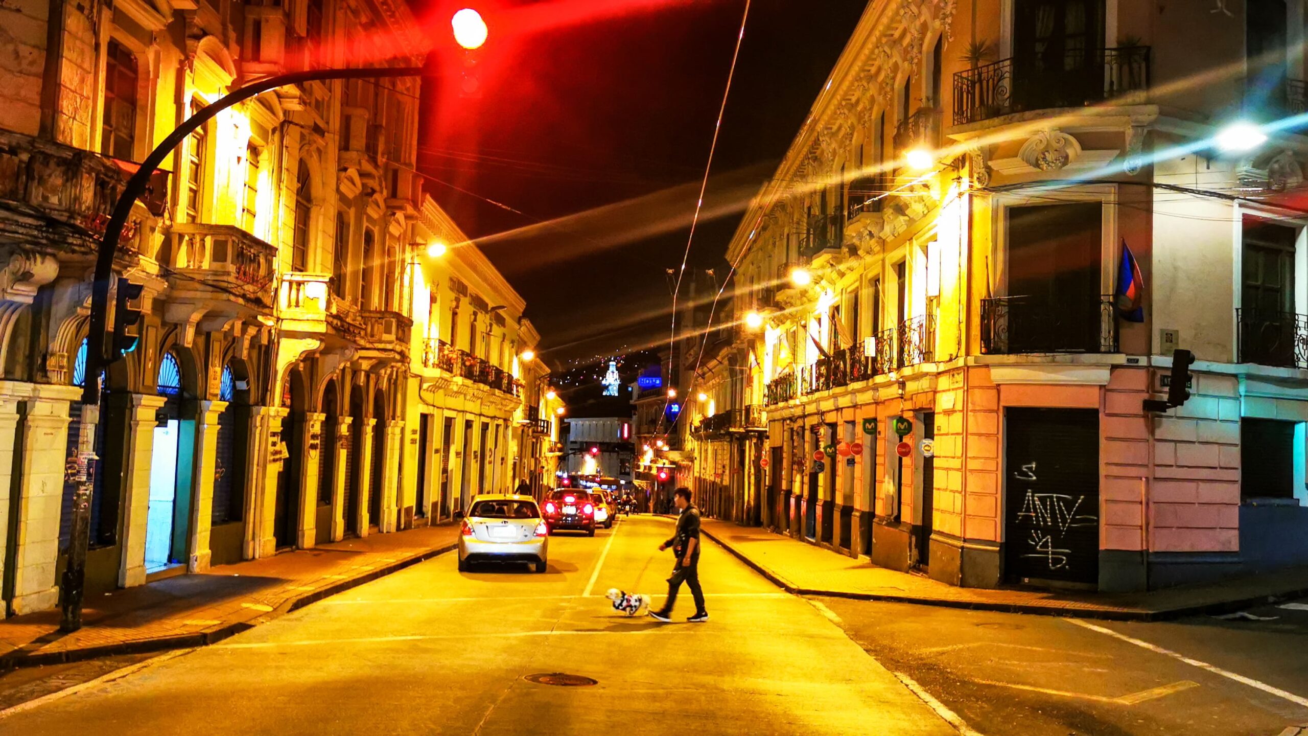
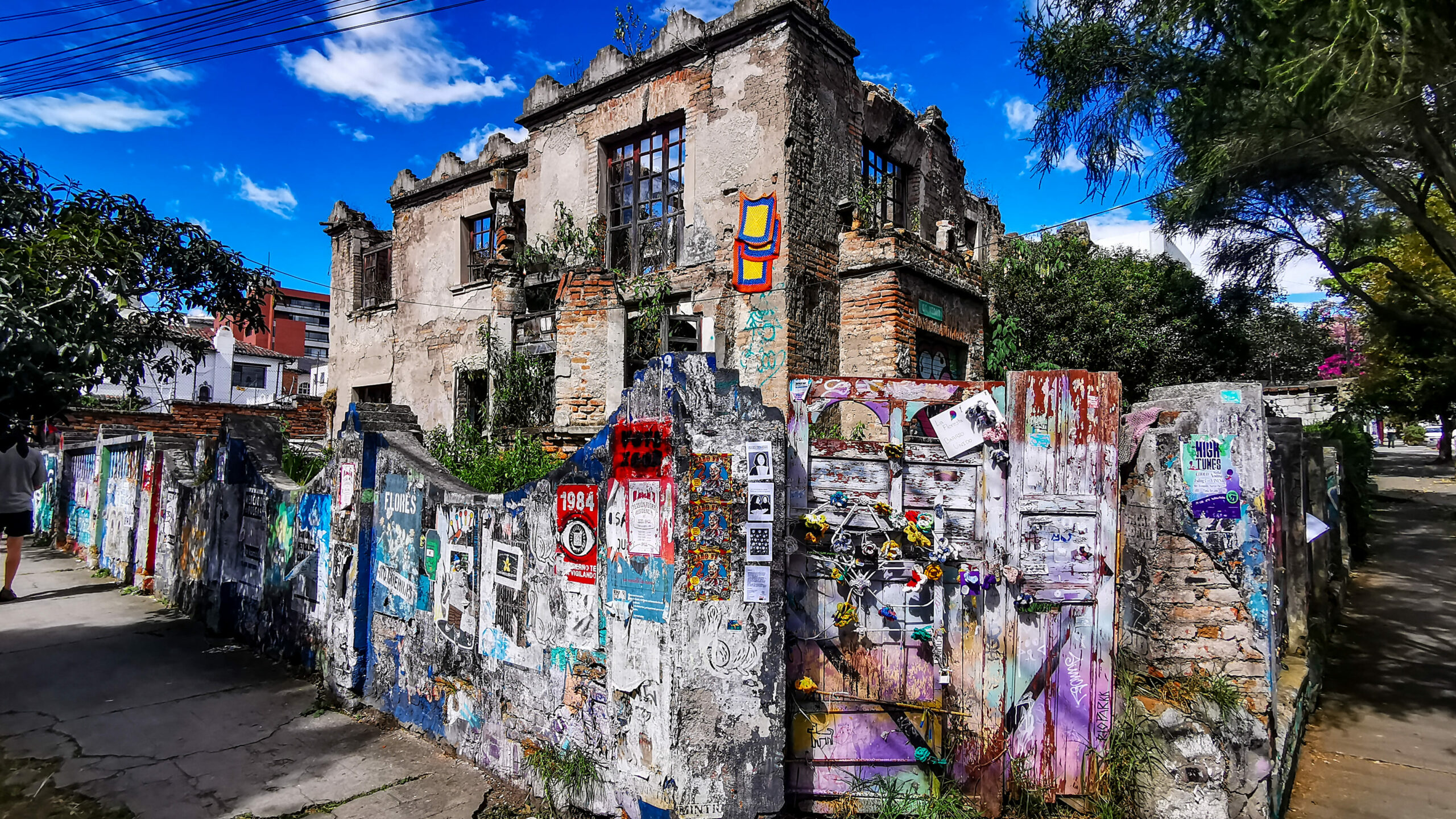
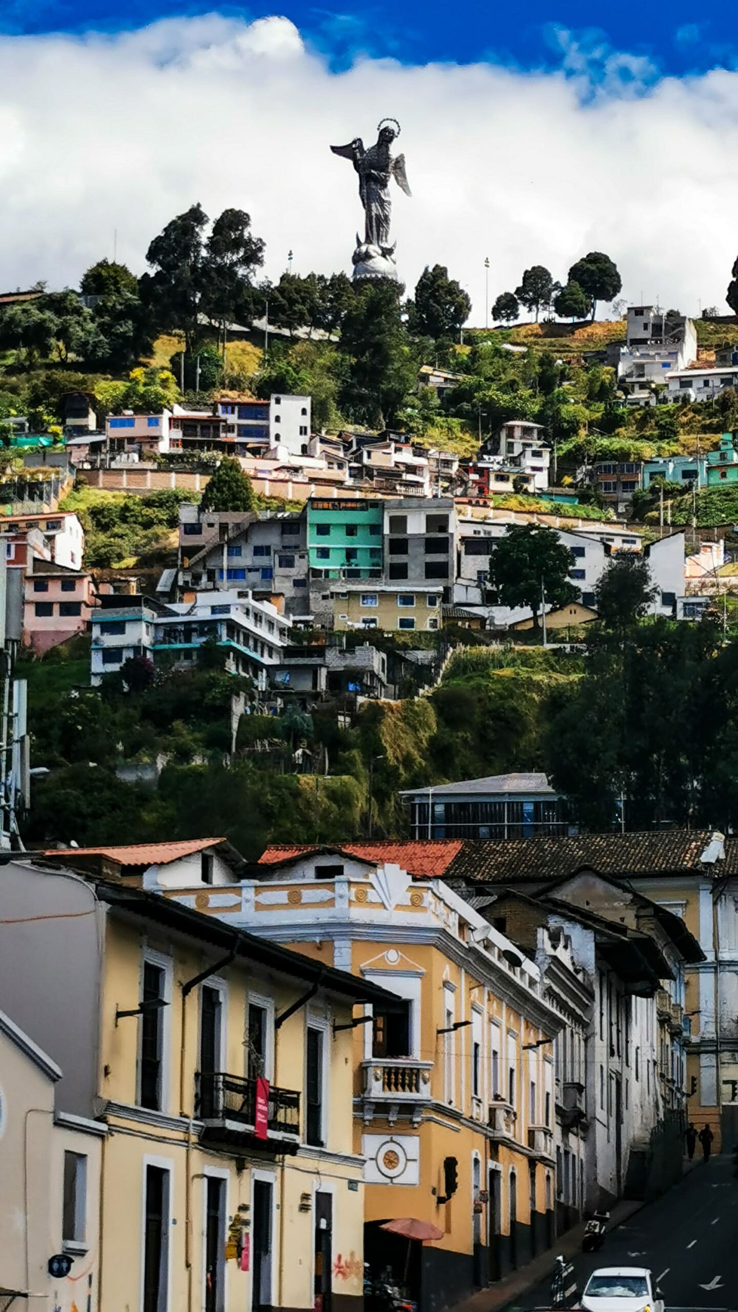
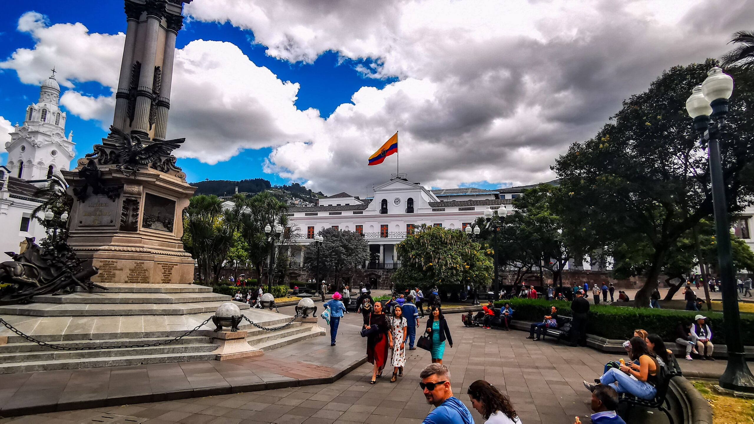
After meanwhile 13,000 km my tires were already properly worn. It was now absolutely necessary to change them. Despite countless bike stores, it was already in Colombia almost impossible to find the right touring bike tires for my bike. A bike store did not have the tires I needed in stock, but was able to order them by the next afternoon. In the morning of the next day I met with Lizzie and Simon, the British bicycle touring couple I had already met in Nicaragua on the island of “Ometepe”. Since they happened to be in “Quito” at the same time as I was, we decided to look at the old town together and have lunch together. “Quito” has a beautiful historic old town. Of all the Latin American cities I had seen so far, the historic center resembles more of a southern European old town in terms of architecture. Especially the gigantic gothic cathedral contributes to this.
The city tour and the meeting with Lizzie and Simon were really nice. Especially to see them again after the months was great. Maybe we will meet again in the course of my tour.


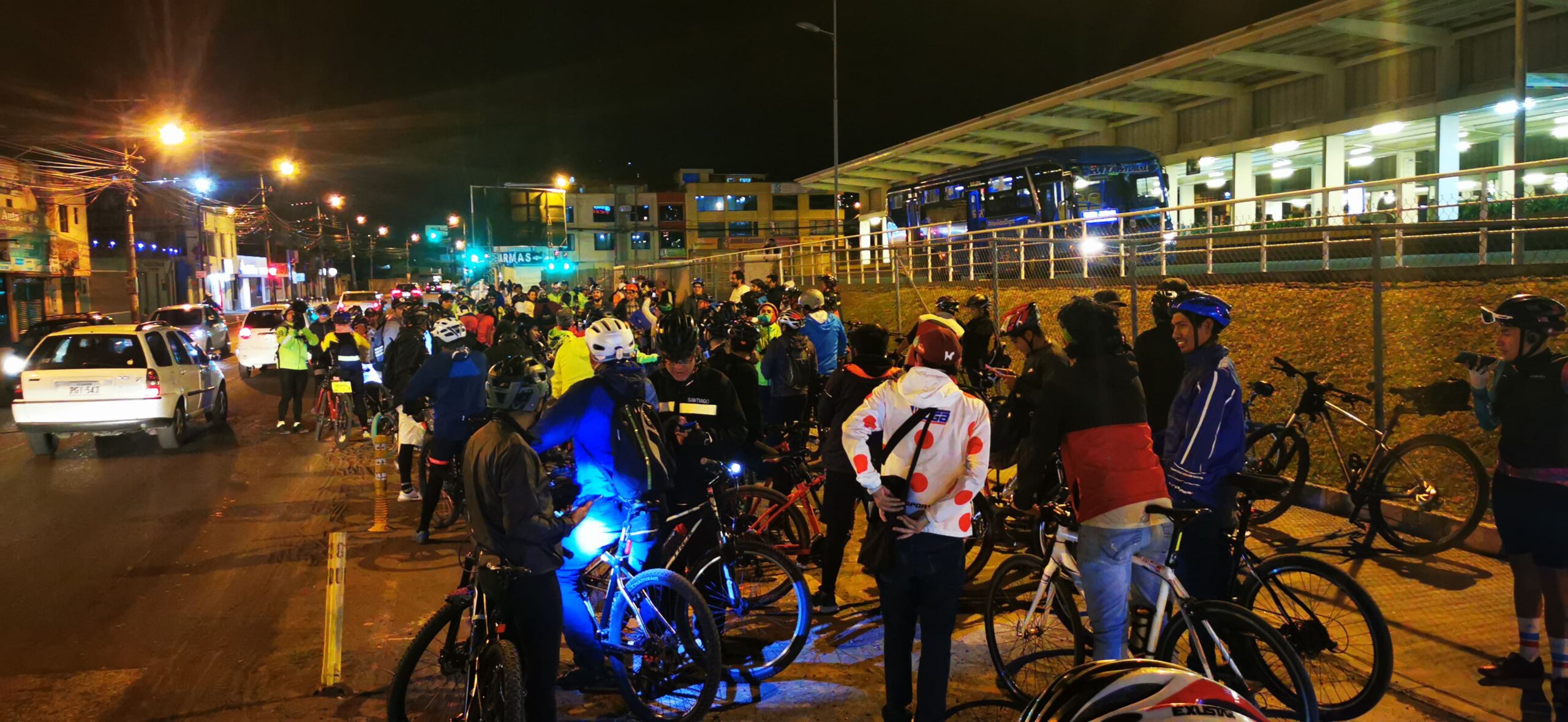
After the city tour I went to the bike store to have my new tires mounted. I hope that with these tires I will now get to the end of my journey to “Ushuaia”. The boss of the store invited me in the evening still to a bicycle event in the city. We met at 19 o’clock at the bicycle store and rode together with a few friends to the south of the city. From time to time more cyclists joined us and we became a handsome group. South of the city center we met then a huge association of cyclists. In total, we were easily 500 cyclists and set off in convoy to ride through the center. In order to create attention for cyclists and above all, to honor the many cyclists who died, this meeting took place for the first time in “Quito”. The roads were closed and car and motorcycle traffic stopped for a while. Until 12 o’clock at night all cyclists rode through the streets.
Different than originally planned, it was clear for me to leave the Panamericana from “Quito” and to go over the Andes to the Amazon lowlands. A long-awaited dream of mine was to see the Amazon once. From the Ecuadorian “El Coca” I wanted to take a ship to “Iquitos”. “Iquitos” is a large city on the Amazon River, which lies like an island deep in the Peruvian rainforest and can only be reached by air or water.
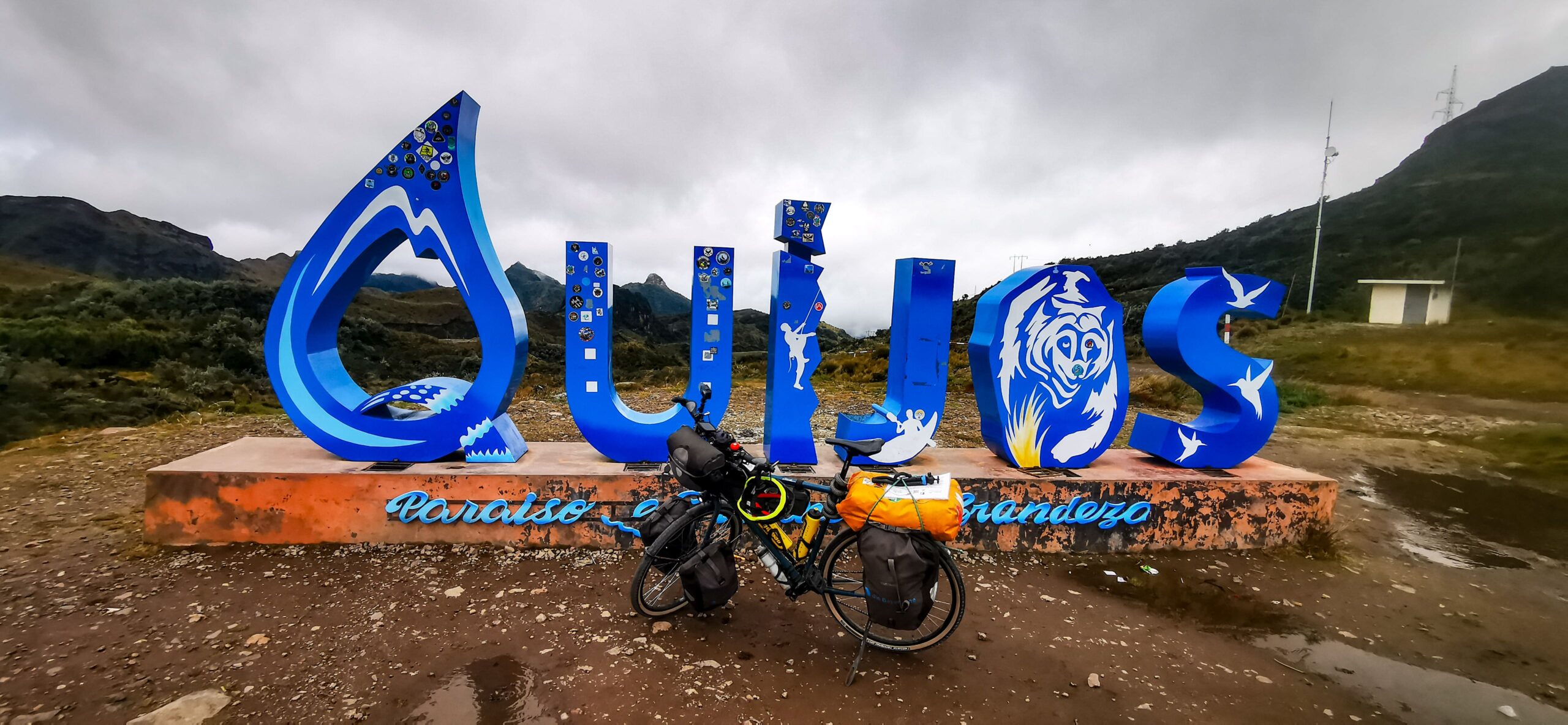
So it happened that I went from “Quito” to the west. I would have to skip the famous volcanoes, like the 6200 meter high “Cimborazo”. An Amazon adventure was worth it to me in any case. After all, on the ascent of the 4100 meter high pass “Corpóreas QUIJOS” I had a short view of the second highest mountain in Ecuador, the 5800 meter high “Cotopaxi”.


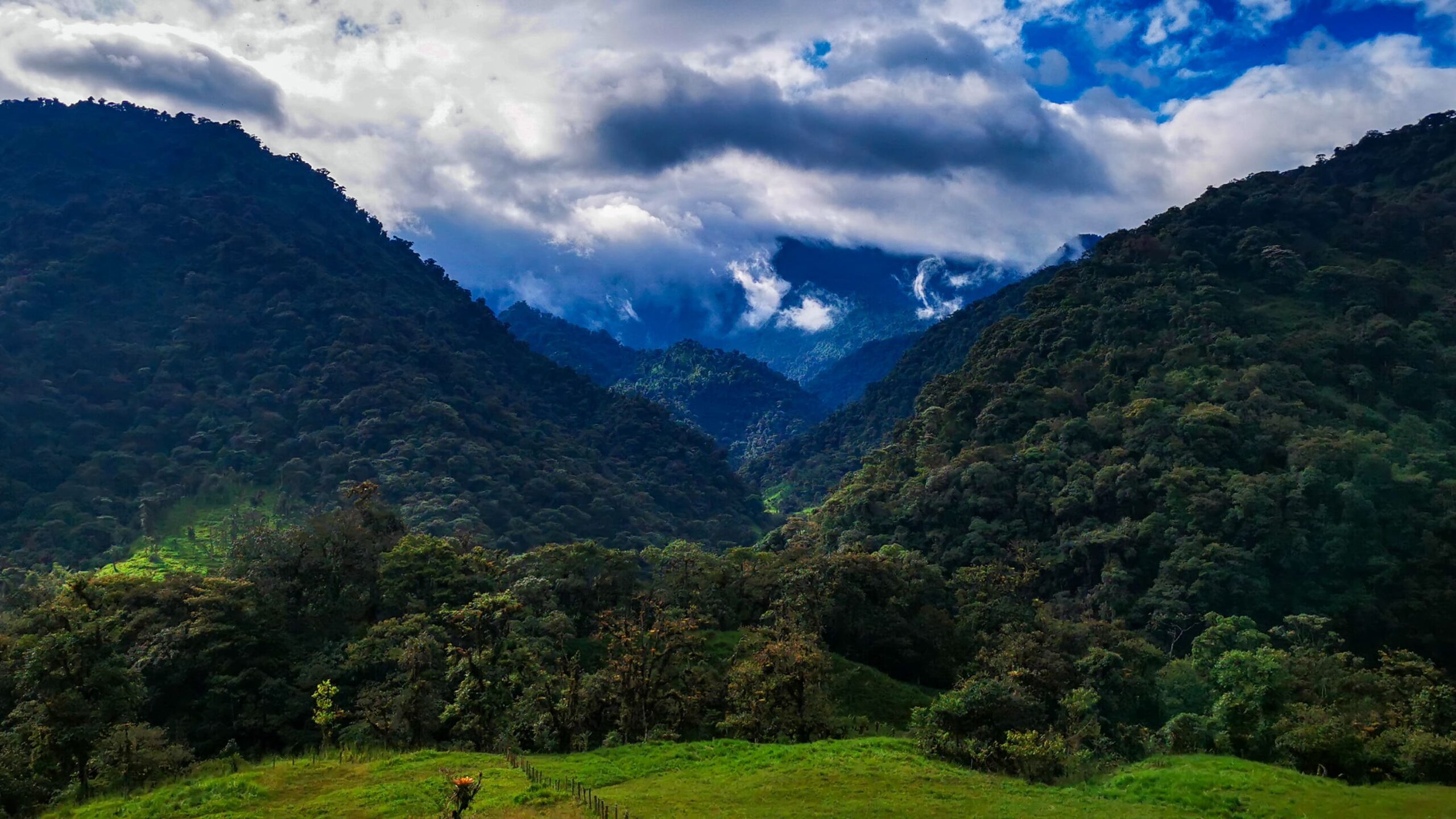
Surprisingly, the ride was relatively smooth. Despite the 4100 meters, I had no problems with the altitude. The only issue was the cold and the icy wind. The descent was gorgeous and stretched down over 50 km. From the barren highlands it went over to the rainforest. The road ran parallel to a deep cutting valley. At some point the road made a bend and I drove directly towards three gigantic waterfalls. What a spectacle!
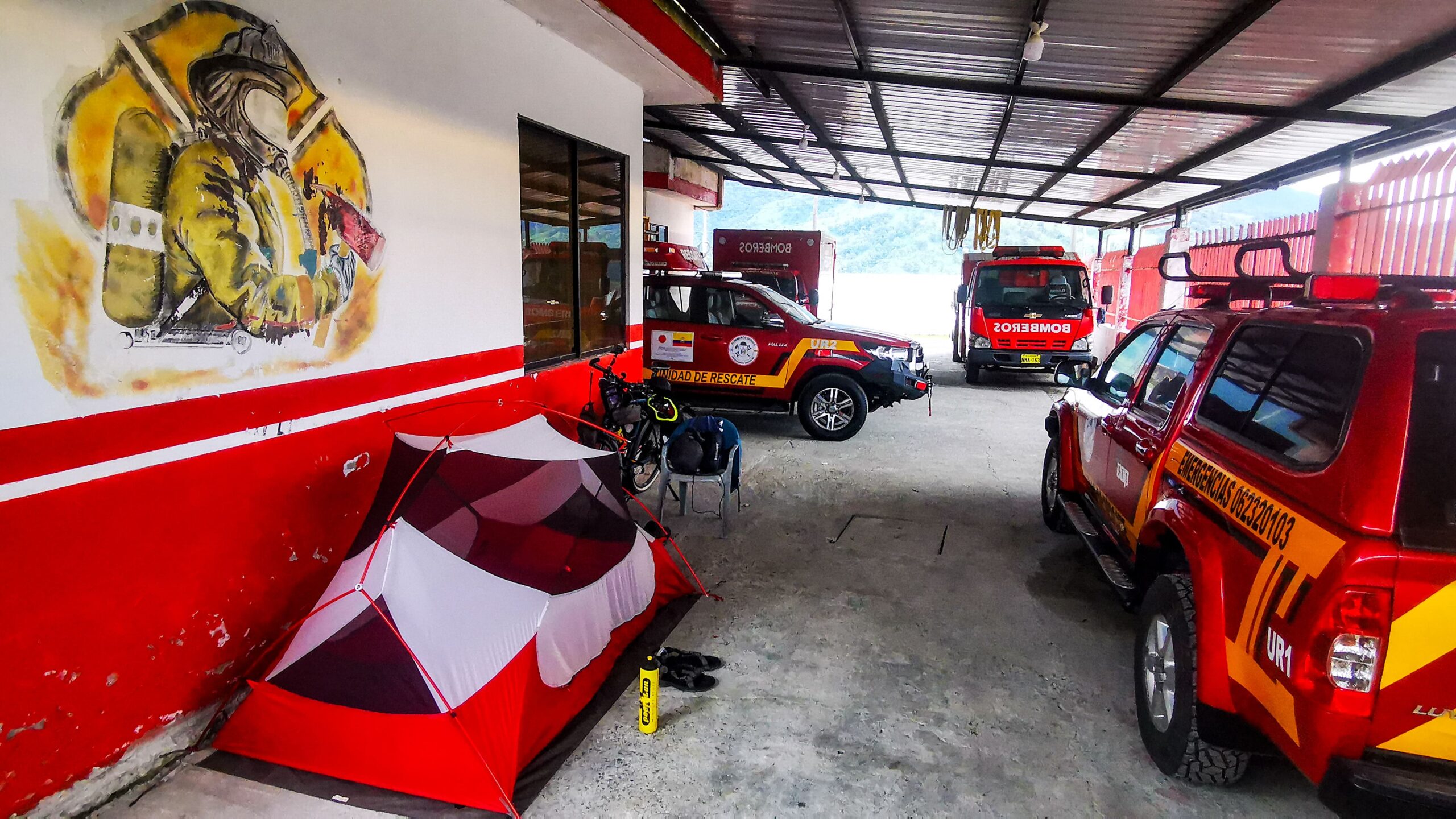
In the afternoon I arrived in “Baeza”, a small town and stayed overnight with the Bomberos, the local fire department. In many Latin American countries, it is the custom for the fire department to take in travelers and provide them with a roof over their heads. I was also a member of the volunteer fire department in my hometown until my trip began. Proud to have a German comrade visiting, they showed me around and showed me the equipment and vehicles. Since in Ecuador only few means are available for institutions such as the fire department or the Red Cross, operation clothes or special equipment are renewed only very rarely. Most of the time, a firefighter only gets their turnout gear once during their career. As a result, they often go out in singed and patched turnout gear that no longer gives them the protection they need, or in some cases, any protection at all. It was particularly frightening that they had no breathing apparatus and only went out on fires with a cloth in front of their mouths. The commander asked me to use my contacts in Germany to possibly arrange for a donation of clothing or material. They would be very happy to receive decommissioned but still usable equipment.


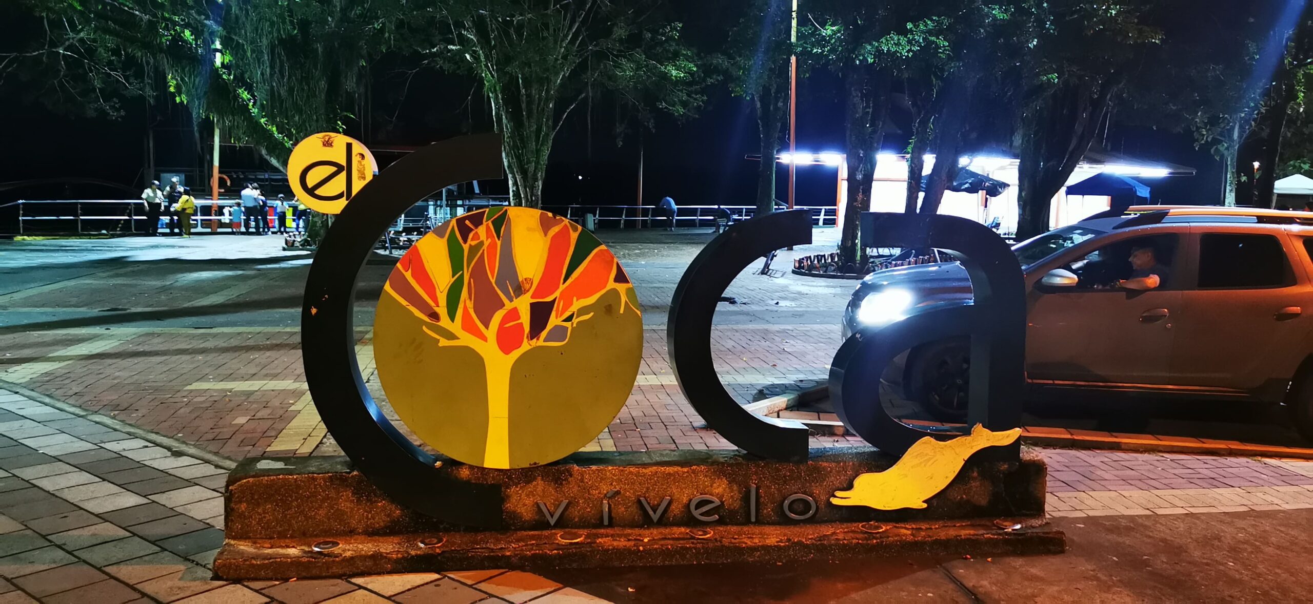
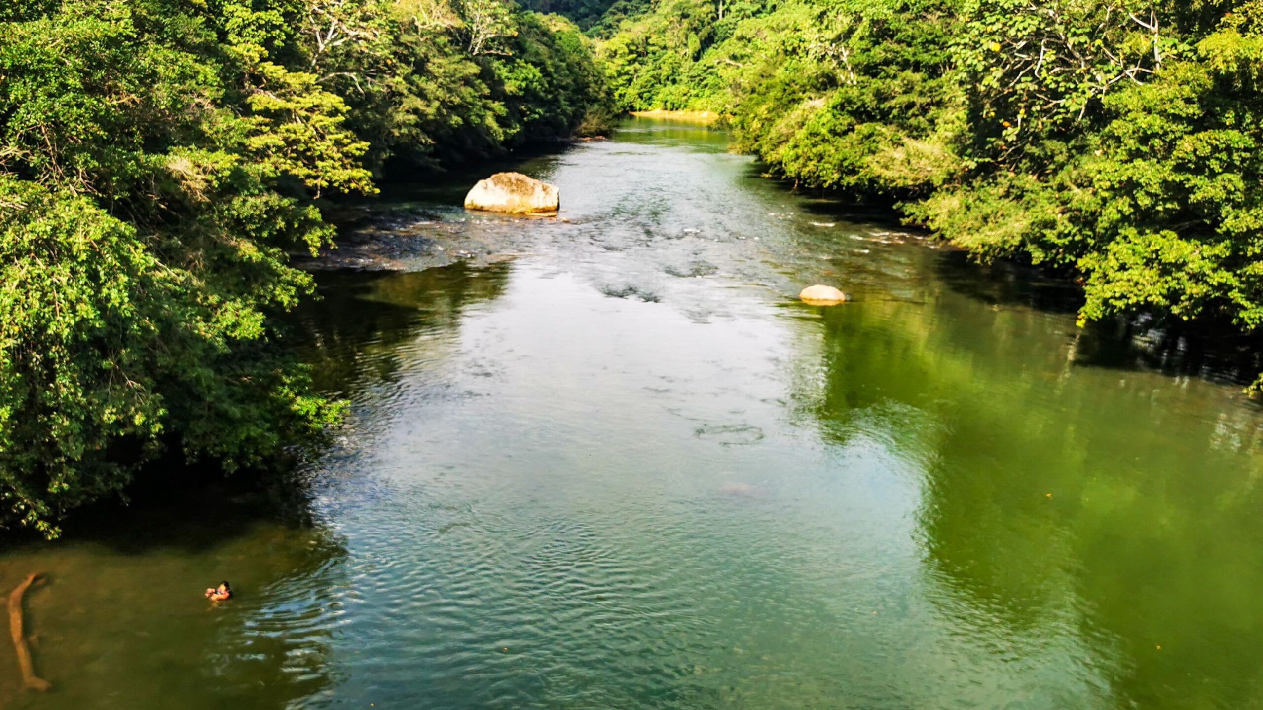
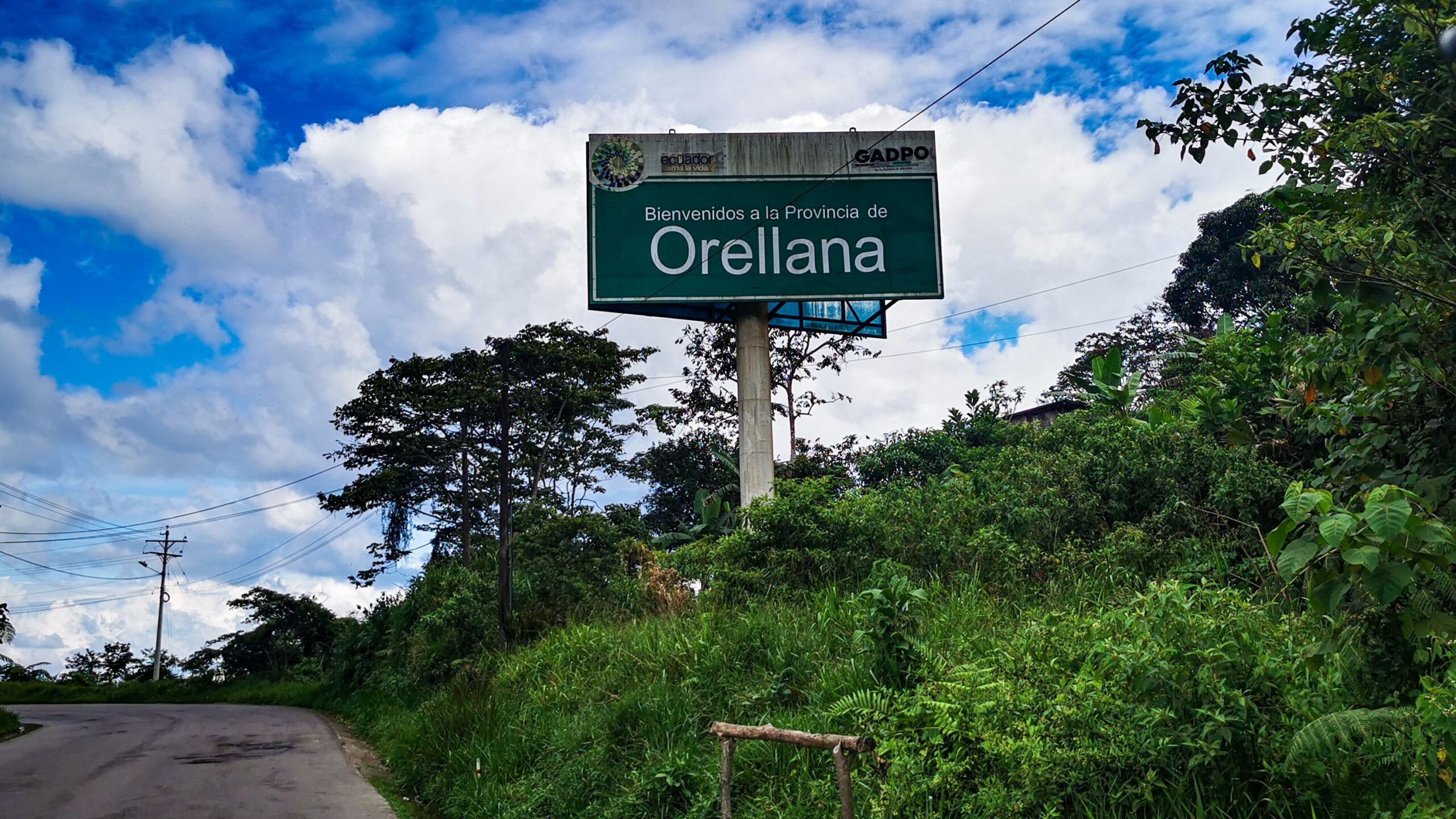
From “Baeza” we continued downhill deep into the Ecuadorian lowlands. Here there is nothing but rainforest and very rarely a small settlement. After more than 150 km I arrived in “El Coca”, a town with 45,000 inhabitants. “El Coca”, originally known as “Puerto Francisco de Orellana”, named after the Spanish conquistador who was the first to navigate the Amazon from its source to its mouth, is located on the “Rio Napo”, a tributary of the Amazon and is characterized by the oil industry. The city is still very young and has only grown because of the oil that has been extracted from the rainforest here for a few decades. From Ecuador, this is the only way to reach the Amazon by water.

